Skip to content
MyKoreanTrip

Mountain park · Gangwon

Seoraksan National Park

설악산국립공원

Granite spires and the country's most famous autumn colour, near Sokcho.

The best-known mountain park in Korea and a UNESCO Biosphere Reserve since 1982. Daecheongbong tops out at 1,708m, the third-highest point in the country.

Most visitors start from Sogongwon near Sokcho, where a cable car runs up towards Gwongeumseong and the path to the great rock dome of Ulsanbawi begins. Come in October and you will not be alone — the foliage here draws crowds from the whole country.

Getting there from Seoul

Door-to-door estimates for a normal day; they stretch on a holiday weekend. Check the timetable before you rely on a last bus back.

  • Bus

    Express bus from Seoul Express Bus Terminal to Sokcho, about 2h 30m, then local bus 7 or 7-1 to the Sogongwon park entrance. This is the standard route and runs frequently.

  • Train

    No direct line. The KTX to Gangneung (about 2h) then a bus north to Sokcho works, but the direct coach is simpler and usually quicker.

  • Car

    About three hours on the Yeongdong expressway. Parking at Sogongwon fills early on autumn weekends — arrive before eight or don't drive.

Wildlife & plants

Animals

Long-tailed goral, a cliff-dwelling wild goat and a protected species, lives on the crags here. Also Eurasian otter, musk deer, marten and, at altitude, the Korean hare. Peregrines and golden eagles use the rock faces.

Trees & flowers

One of the richest botanical sites in Korea — over a thousand plant species. Korean fir and dwarf pine on the summit ridge, and the autumn maple that draws the October crowds.

Korea’s wildlife is shy and mostly nocturnal — you’re far more likely to see tracks than animals. Wild boar are the one to know about: keep your distance, don’t run, and never get between a sow and her young.

What grows and lives here

The mountain up close

Seoraksan is a UNESCO Biosphere Reserve and has been since 1982, Korea’s first. Roughly 1,300 plant species grow here and the fauna list runs past 40 mammals and over a hundred birds — but the animal the park is really built around is the Korean goral, a stocky mountain antelope that lives on cliffs steep enough to keep everything else off.

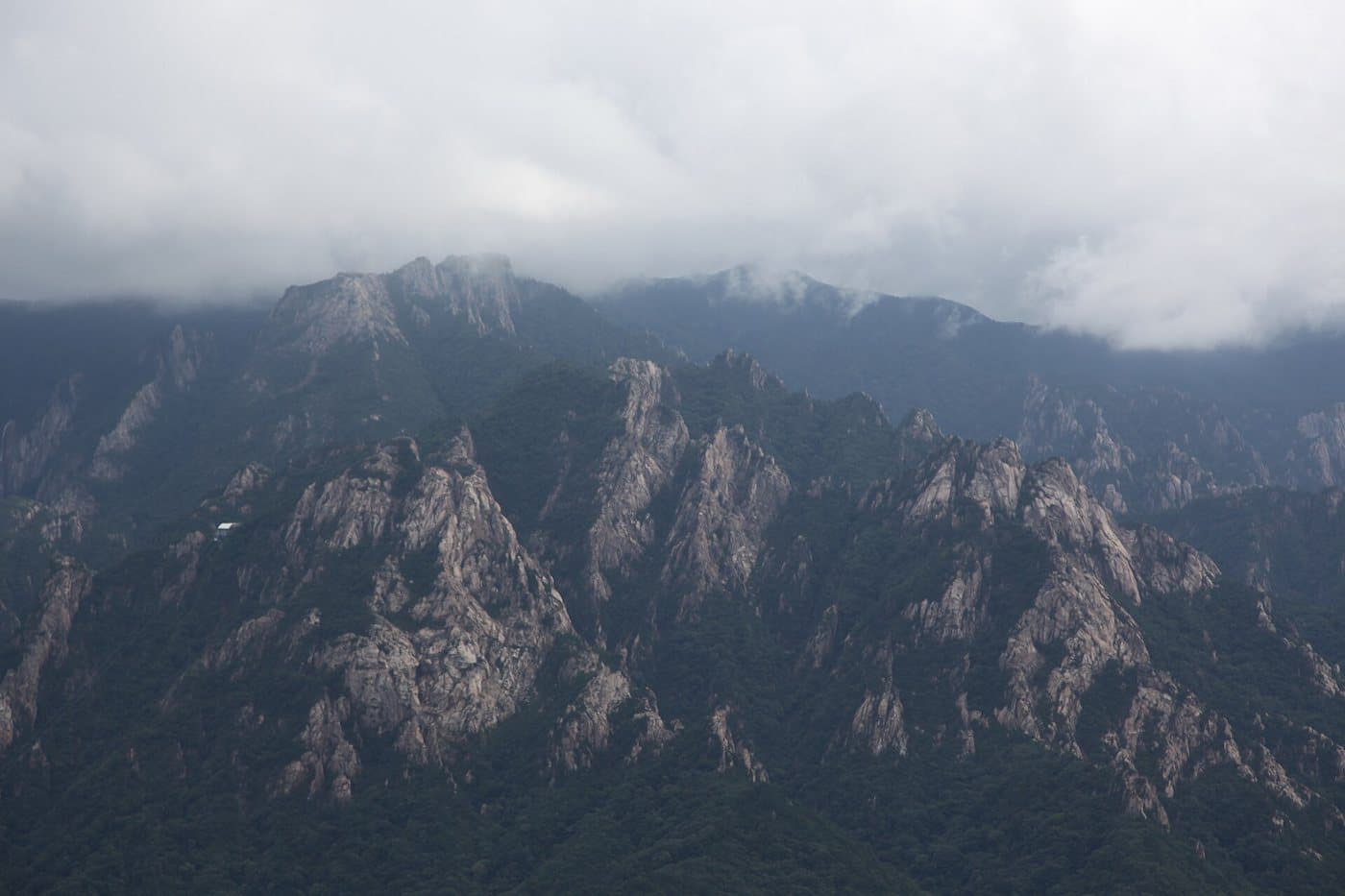
Jagged granite spires of Seoraksan rising through low cloud

Granite spires in the cloud

Seoraksan

Photo by Olga Lipunova, CC BY-SA 3.0

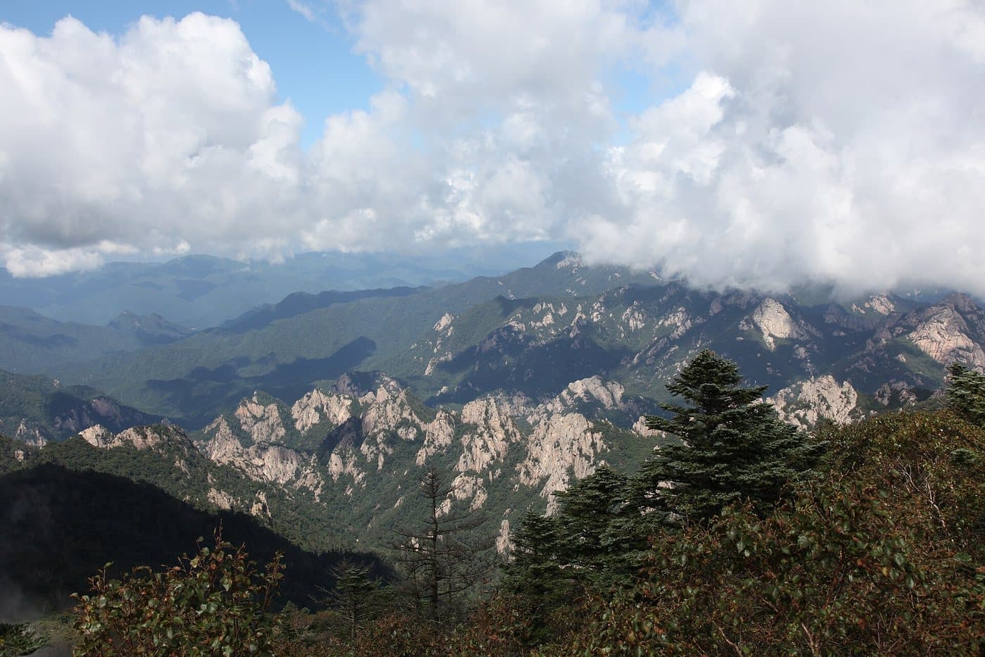
Ridges and valleys of Seoraksan seen from the Daecheongbong summit above the cloud line

From Daecheongbong, 1,708m

Seoraksan

Photo by Olga Lipunova, CC BY-SA 3.0

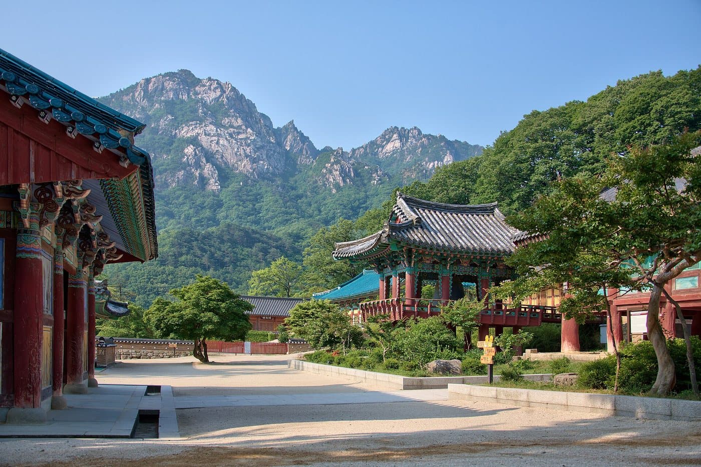
A temple hall with a tiled roof standing below the granite peaks of Seoraksan

Temple buildings under the peaks

Seoraksan

Photo by Buckodoc, CC BY-SA 3.0

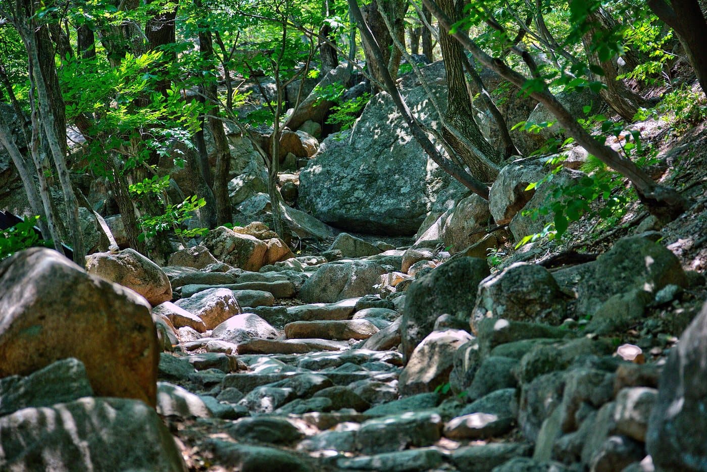
Stone steps climbing through dense green forest between moss-covered boulders

Steps through the boulder forest

Seoraksan

Photo by Buckodoc, CC BY-SA 3.0

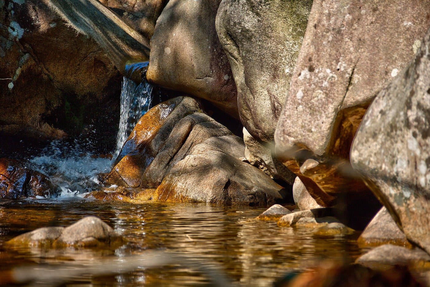
A small waterfall running over smooth rock into a clear pool

One of the valley waterfalls

Seoraksan

Photo by Buckodoc, CC BY-SA 3.0

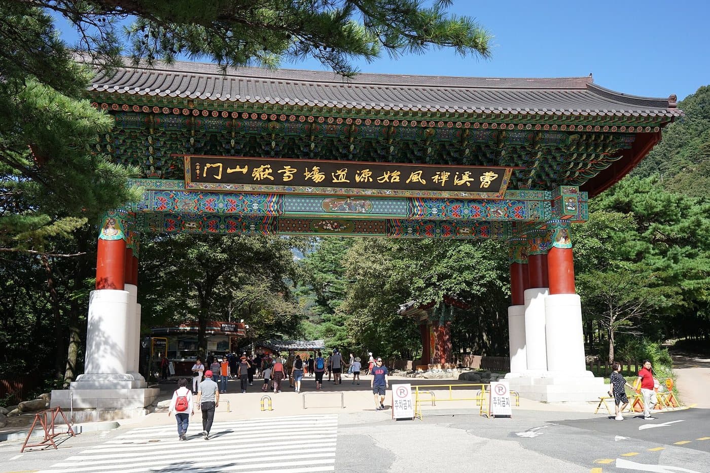
The painted one-pillar gate at the entrance to Seoraksan with visitors walking through

The gate at Sogongwon

Seoraksan

Photo by De-Shao Liu (Terry850324), CC BY-SA 4.0

October is not a secret

Seoraksan turns colour before anywhere else in Korea — the front usually reaches the high ridges in the first week of October and the valleys a fortnight later. It is the single busiest fortnight in any Korean national park. Buses from Seoul sell out, the Sogongwon car park fills before eight, and the queue for the cable car can run past two hours. Go midweek, start early, and book a bed in Sokcho well before you need it.

Walking it

The routes that matter

Seoraksan splits into Outer Seorak on the Sokcho side, Inner Seorak behind it, and South Seorak at Osaek. Almost every first visit happens in Outer Seorak, where the entrance, the cable car and the two famous short walks all are.

Ulsanbawi

The one everyone comes for

Distance
3.8 km
Time
4–5 hr return
Grade
advanced

Route: Sogongwon → Sinheungsa → Heundeulbawi → Ulsanbawi ridge

Getting to the start: Bus 7 or 7-1 from Sokcho Intercity Bus Terminal to the Seoraksan entrance.

Only 3.8km each way, and most of it is gentle — then it turns into roughly 800 steel steps up the side of the rock. Nothing technical, but it is relentless, and the last section is exposed. There are 808 of them by the official count. The rock itself is six granite peaks in one ridge, 4km around and topping out at 873m.

Biseondae and Geumganggul

Short, or short plus a hard finish

Distance
3.6 km
Time
2 hr to the cave
Grade
average

Route: Seorakdong → Biseondae → Geumganggul cave

Getting to the start: Same entrance as Ulsanbawi; turn right rather than left.

The walk to Biseondae is about 3km and nearly flat — a river of smooth granite slabs, and fine for anyone. Carrying on up to Geumganggul, a cave shrine in the cliff, is a steep staircase that takes most people another 40 minutes each way.

Daecheongbong via Osaek

The summit, the short way

Distance
5 km
Time
4 hr up
Grade
advanced

Route: Osaek ranger station → Seorak waterfall → Daecheongbong (1,708m)

Getting to the start: Intercity bus to Osaek on the southern side, not Sokcho. Plan the return before you set off.

The shortest line to the roof of Seoraksan and, unsurprisingly, the steepest — 1,200m of climb in 5km, with no easy section. Start at first light. Many people go up here and down the long way to Sogongwon rather than returning the same way.

Cheonbuldong valley

The long, beautiful way

Distance
5 km
Time
Full day to the summit
Grade
advanced

Route: Biseondae → Cheonbuldong valley → Huiungak shelter (5km), then on to Daecheongbong

Getting to the start: From Sogongwon, continuing past Biseondae.

The Valley of a Thousand Buddhas: five kilometres of waterfalls and pools between the walls, from Biseondae up to the Huiungak shelter. Carrying on to Daecheongbong from there turns it into a very long day, and published distances for the full through-route vary, so plan on the shelter as your marker rather than a total.

Gwongeumseong cable car

No walking required

Distance
0.6 km
Time
10 min each way
Grade
easy

Route: Sogongwon → Gwongeumseong upper station → fortress viewpoint

Getting to the start: At the main entrance. Tickets are timed and sell out in autumn.

Ten minutes up to a ruined fortress site with the whole of Outer Seorak in front of you. There is a short rocky scramble from the upper station to the best viewpoint — trainers are fine, but it is uneven.

Distances are the published trail figures for each route; times are round trip unless stated. Upper trails close seasonally for fire risk and snow — check at the visitor centre on the day.

Why it is protected

Korea’s first biosphere reserve

1970
Designated
1982
Biosphere reserve
398 km²
Area
1,708 m
Daecheongbong

Seoraksan was made a natural monument in 1965, five years before it became a national park, and in 1982 UNESCO made it Korea’s first Biosphere Reserve. It is the third-highest mountain in the country after Hallasan and Jirisan, and the highest in the Taebaek range that runs down Korea’s eastern spine.

The rock is what people come for: granite and gneiss weathered into spires, slabs and free-standing towers. Ulsanbawi is six granite peaks in a single ridge, roughly 4km around and 873m at its highest. Heundeulbawi, the rocking stone, is a boulder balanced so finely that one person can visibly move it and a hundred cannot push it over.

Above about 1,300m the mountain turns alpine, and the dwarf stone pine on the summit ridge is protected as a strict nature reserve — you can walk to Daecheongbong but not off the path at the top. The Korean goral, a cliff-dwelling antelope and one of Korea’s most endangered mammals, lives on the faces below.

The park covers 398 km² across four districts, and it is worth understanding the split before you book. Outer Seorak, on the Sokcho side, has the entrance, the cable car and the two short famous walks, and takes the overwhelming majority of visitors. Inner Seorak, reached from Inje and Baekdam, is quieter and wilder. South Seorak at Osaek is the steep back door to the summit.
More parks

All 23 national parks →