Skip to content
MyKoreanTrip

Mountain park · Gwangju, South Jeolla

Mudeungsan National Park

무등산국립공원

Gwangju's mountain, with columns of volcanic rock along the ridge.

Mudeungsan rises straight out of Gwangju and is the city's weekend walk. The ridge carries three groups of columnar joints — Ipseokdae, Seoseokdae and Gwangseokdae — stone pillars formed as lava cooled, which earned the park UNESCO Global Geopark status in 2018.

The true summit is inside a military area and closed most of the year, but the ridge below it is open and the views are the same.

Getting there from Seoul

Door-to-door estimates for a normal day; they stretch on a holiday weekend. Check the timetable before you rely on a last bus back.

  • Train

    KTX to Gwangju Songjeong, about 1h 40m, then city bus. The park starts at the edge of the city.

  • Bus

    Express coach to Gwangju, around 3h 30m.

  • Car

    About three and a half hours, though once in Gwangju the city buses are easier than parking.

Wildlife & plants

Animals

Wild boar and roe deer close to a metropolitan city, which tells you how well the mountain is protected. The upper slopes are a restricted military area, which has kept them undisturbed.

Trees & flowers

Old broadleaf forest with a large natural stand of nutmeg yew. The columnar joints themselves carry specialised lichen and moss communities, part of why the park is a UNESCO Global Geopark.

Korea’s wildlife is shy and mostly nocturnal — you’re far more likely to see tracks than animals. Wild boar are the one to know about: keep your distance, don’t run, and never get between a sow and her young.

What grows and lives here

The mountain up close

Mudeungsan rises straight out of Gwangju — a million people live at its feet — and the top is a broad brown grassland scattered with something rare: colonnades of stone columns, formed as volcanic ash cooled about seventy million years ago, standing in ranks like organ pipes.

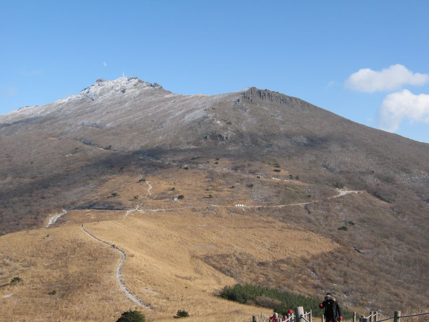
The broad grassy dome of Mudeungsan's summit ridge under a clear sky

The open summit grassland

Mudeungsan

Photo by gary4now, CC BY 2.0

Brown grassy upper slopes of Mudeungsan with scattered rock outcrops

Rock breaking through the grass

Mudeungsan

Photo by gary4now, CC BY 2.0

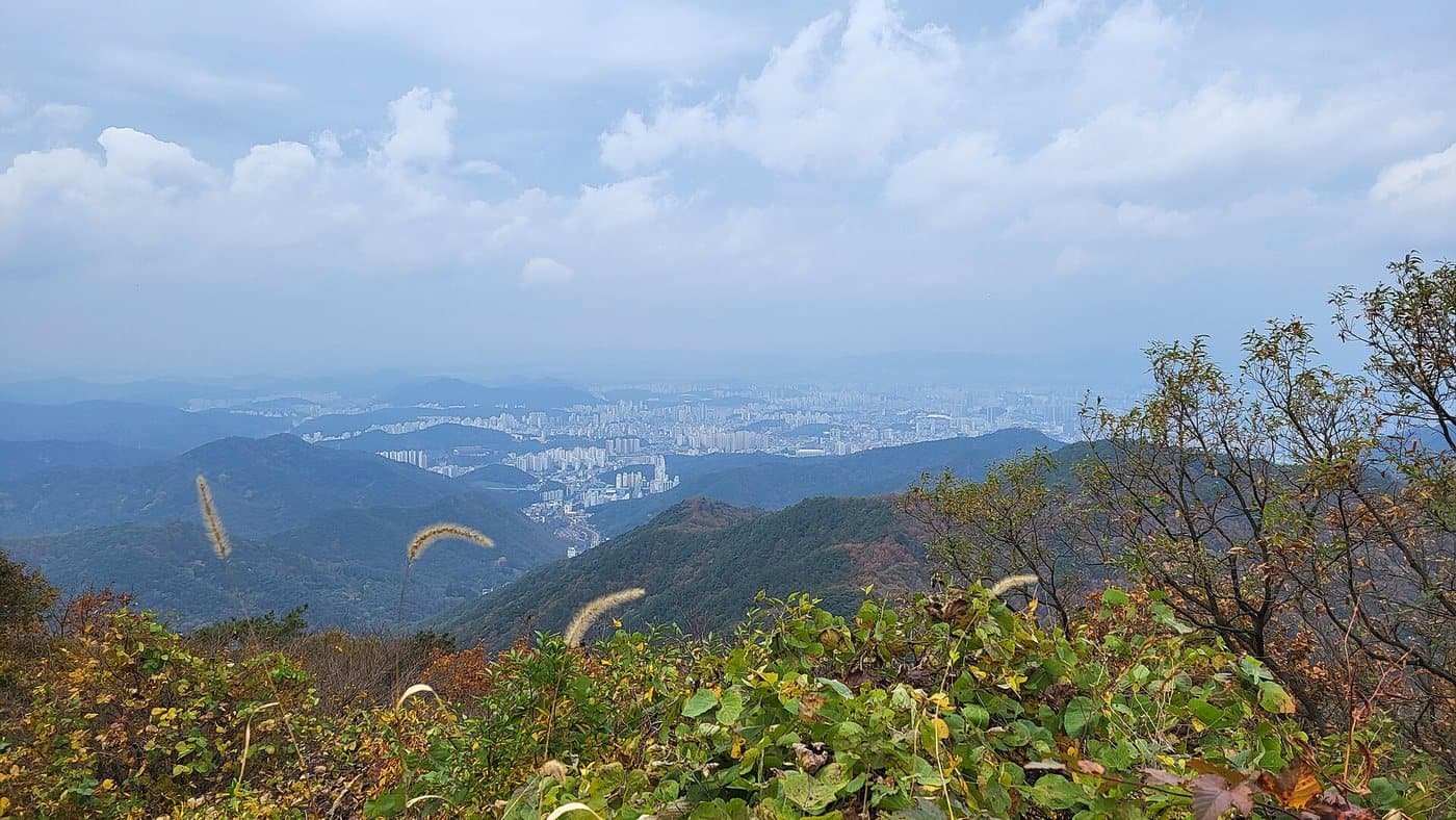
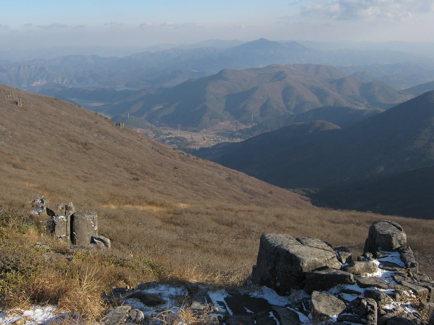
The view from Mudeungsan out over hazy hills and the city below

Gwangju, from the mountain

Mudeungsan

Photo by VaneTrz20, CC BY-SA 4.0

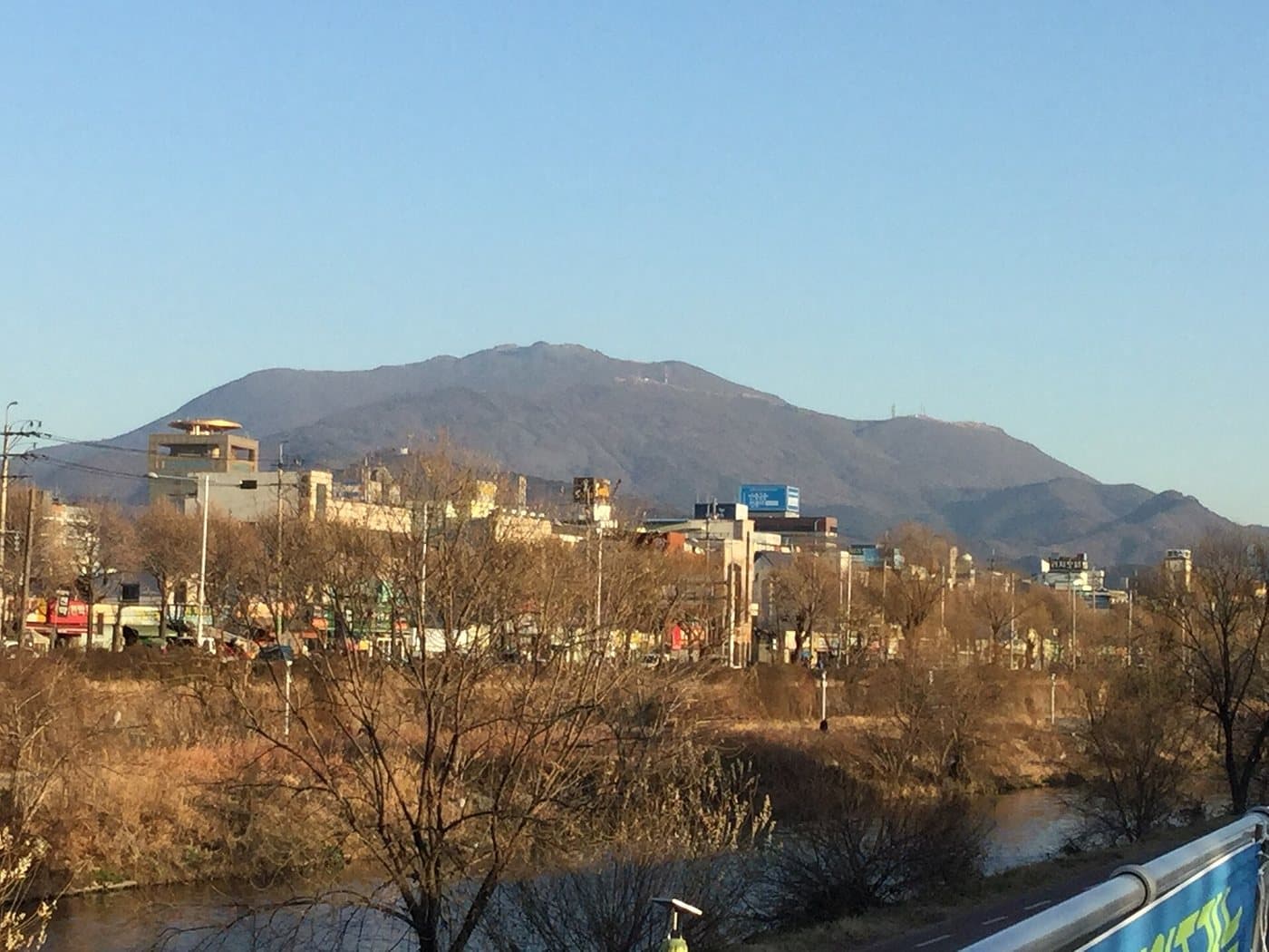
The wooded lower slopes of Mudeungsan meeting the edge of Gwangju

Where the city stops

Mudeungsan

Photo by Kgw1226, CC BY-SA 4.0

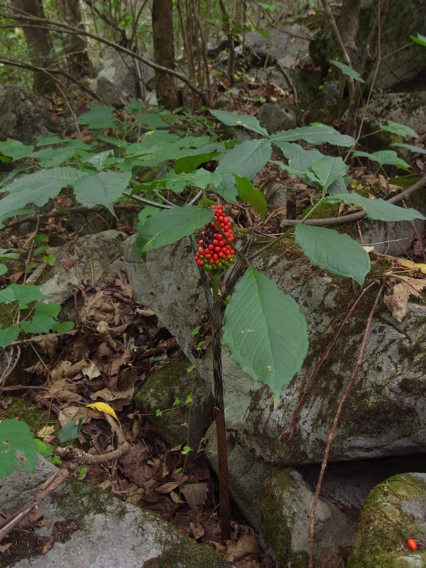
A Korean cobra lily with a cluster of red berries on the forest floor

Korean cobra lily, on the forest floor

Mudeungsan

Photo by Dalgial, CC BY-SA 3.0

The summit itself is army ground

Cheonwangbong, the 1,187m high point, is a military installation and closed to the public for most of the year. This is not a problem in practice — the columnar joints at Seoseokdae and Ipseokdae are what you came for and both are open — but do not plan on standing on the actual top.

Walking it

Up from the city

Mudeungsan is the most convenient big mountain in Korea after Bukhansan: a city bus from central Gwangju drops you at the trailhead, and you can be on open grassland two and a half hours later.

Jeungsimsa to Seoseokdae

The main route

Time
2 hr 30 min up
Grade
average

Route: Jeungsimsa → Junmeori → Seoseokdae (1,100m)

Getting to the start: City bus running to Jeungsimsa from central Gwangju.

The standard way up, from the temple at the foot of the mountain to the great colonnade of Seoseokdae. Steady and well made rather than steep, and busy at weekends with people from the city.

Wonhyosa to Ipseokdae

The quieter side

Time
2 hr up
Grade
average

Route: Wonhyosa → Neoritjae → Ipseokdae

Getting to the start: Bus to Wonhyosa on the northern side.

Comes up to Ipseokdae, the ‘standing stone platform’, where the columns are most obviously column-shaped. Fewer people than the Jeungsimsa side.

Jungmeorijae ridge walk

Along the top

Time
2 hr
Grade
easy

Route: Seoseokdae → Ipseokdae → Jangbuljae grassland

Getting to the start: Once you are up, using either route above.

The walking along the top is nearly flat, over open grass. In October the silver grass at Jangbuljae is the reason half of Gwangju is up here.

Given by walking time; routes are signed from Jeungsimsa and Wonhyosa.

UNESCO Global Geopark

Stone columns above a city

2012
Designated
75 km²
Area
1,187 m
Cheonwangbong
≈70 m years ago
Columns formed

Mudeungsan became a national park in 2012, the twenty-first, largely on the strength of its geology. Around seventy million years ago a thick sheet of volcanic ash settled here, welded itself into solid tuff under its own heat, and then cooled — and cooling rock contracts and cracks into polygons, the same way drying mud does. The result is colonnades of stone columns up to thirty metres tall.

The three great sets are Seoseokdae, Ipseokdae and Gyubongam, all above 700m. Columnar jointing is not rare on its own — the Giant's Causeway is the same process — but it is normally found in basalt, and finding it on this scale in welded tuff is unusual enough that UNESCO made the mountain a Global Geopark.

The name means ‘the mountain without equal’, or, read another way, the mountain where there are no ranks and no distinctions. Gwangju has taken that second reading to heart; the mountain is bound up with the city's identity, and with the memory of the 1980 uprising.

Practically, it is a city mountain. You can leave a café in central Gwangju after breakfast and be standing among seventy-million-year-old stone columns before lunch.
More parks

All 23 national parks →